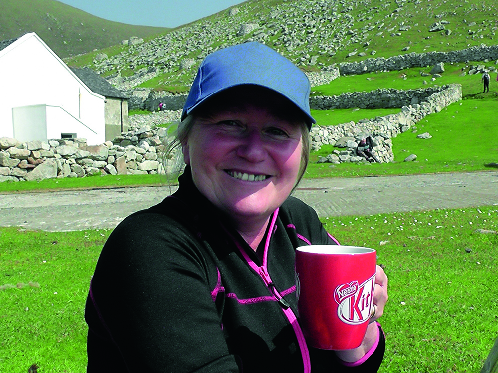
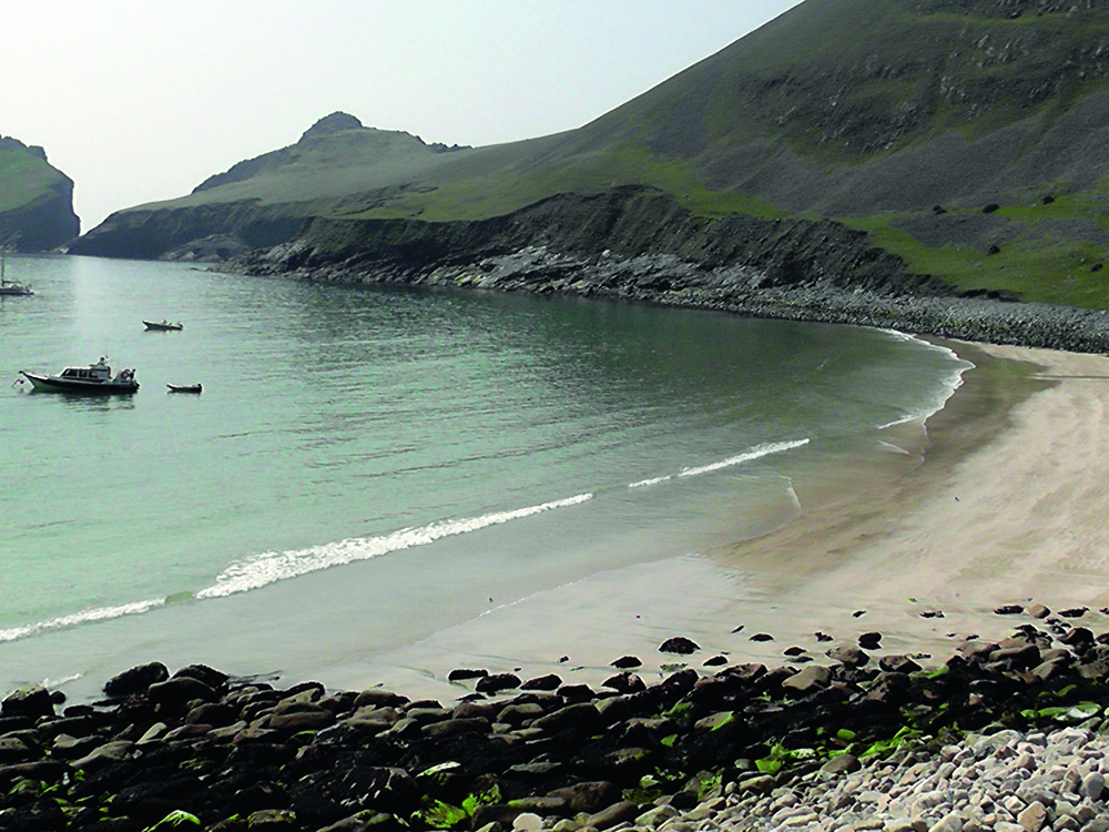
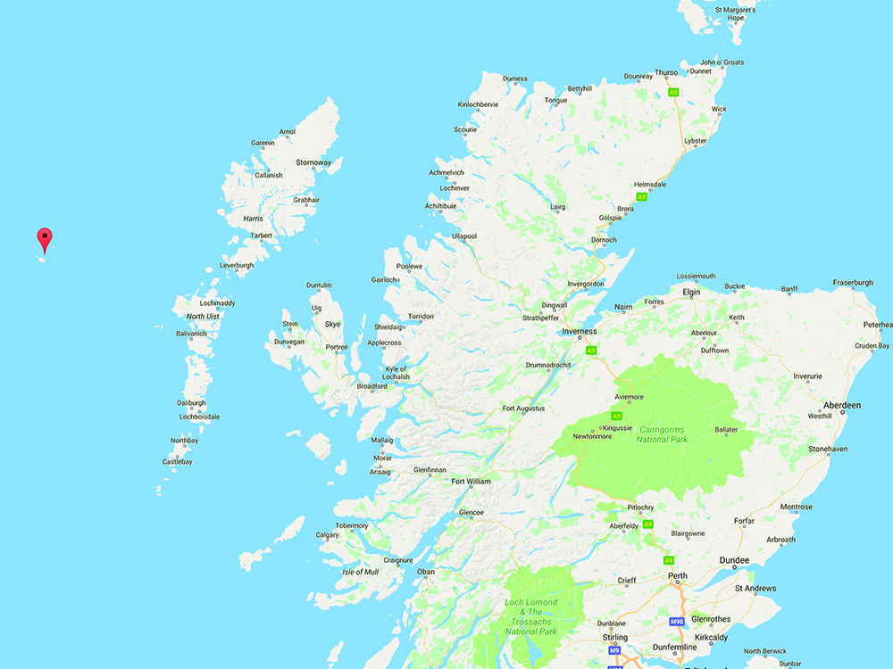
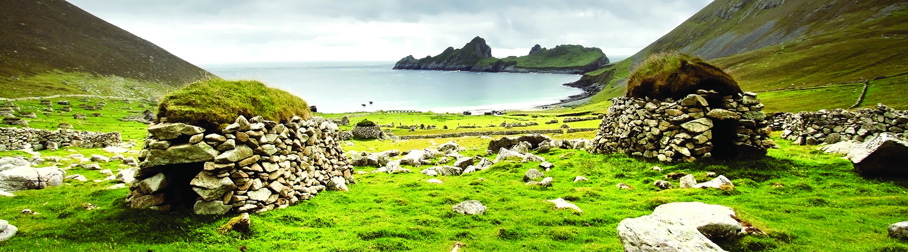
Philip Hastain shares with PBR readers the tale of a trip with family and friends to the remote and mystical islands of St Kilda…

My wife and I developed an interest in RIBs just over two years ago when we went to stay on a small private island with holiday accommodation in a little village called Badachro, near Gairloch, on the north-west coast of the Scottish Highlands. One of the most successful Scottish whale-watching companies, Hebridean Whale Cruises, run by Nick Davies, is based in Gairloch and we undertook a trip with them to the Shiant Islands situated about 28 miles across the Minch from Gairloch and about 4 miles from the Isle of Lewis. The trip was a great success, and although it was good value for money, the tickets were expensive enough to stop it being a daily occurrence. We began to wonder if this was something we could do ourselves if we had our own boat.

Having undertaken another couple of trips on different RIB rides in South and North Wales, we asked the skipper of the North Wales ride whether or not owning a RIB and whale watching ourselves was beyond our dreams. He advised us where to start, and so we began arranging training courses and establishing exactly what type of RIB we were going to buy.

Our aim was to be able to return to the same island in Scotland with our own boat, going out each day to the same whale-watching grounds but under our own steam, and staying out for as long as we wanted to. Having sought a lot of advice, we set about sourcing the make and model of RIB that we had settled on. In the meantime, basic powerboat and VHF courses were undertaken.

We found the RIB and engine that we wanted at a brokerage on the south coast and purchased it after a test ride. Having got our RIB home, we undertook one-to-one ‘own boat training’ with an advanced powerboat instructor from a local powerboat firm on the River Mersey and then started getting some experience in using it by ourselves – first on the Mersey, and then into North Wales on the Menai Straits and around Anglesey.

In our first year we got the boat up to Scotland and did the journey to the Shiant Isles that we had aimed for. It was fantastic to be able to do our own whale watching for as long as we wanted to each day. At this stage we had purchased a set of hydrophones from a specialist firm in America, with the advice of a National Geographic sound engineer, and soon we were filming and sound recording dolphins as we went. We continued our trips using the boat around the Menai Straits and Anglesey for two seasons, circumnavigating the latter many times, a trip of about 75 miles. Having gained some experience, we decided to start looking further afield for more unique places to visit, and began researching St Kilda.


Anchors Away

St Kilda was a destination we had heard and read about in nature circles. It is an extremely isolated series of volcanic islands that lie 46 miles to the west of the nearest land, the Isle of Harris. It was 96 miles from where we intended to base ourselves in Badachro.

We started planning this trip from January 2016, having booked our holiday accommodation in Badachro, near Gairloch, for June. We made contact with the National Trust for Scotland and outlined our plan. While day charter boats and some yachts visit the islands when weather permits, very few small boats travel there. We were advised that any boat with capacity for storage space, and therefore the capability of inadvertently introducing rats to the island, were prohibited from landing on the island, as, if introduced, rats would decimate the bird population. We were told that only open tenders without storage lockers were permitted (although after our trip we saw pictures of another RIB that had been permitted to land on St Kilda en route to Rockall).

To enable us to land, we purchased a new 3D inflatable 2.5 superlight tender, the lightest on the market at 14.5kg, together with a new Suzuki 2.5hp 4-stroke engine, again one of the lightest 2.5hps on the market weighing in at 13kg. Weight was going to be a factor over a long distance without any chance of refuelling, so the extra weight of 27.5kg was the lightest we could get down to.

Everything we needed for a full day, and potentially two days if the weather turned bad, had to be taken with us from the outset. There are no shops on St Kilda, apart from a small souvenir shop selling T-shirts and other mementos that opens for an hour when the day charter boats arrive. There is no facility for refuelling, no food or drink and no mobile telephone signal.

Our holiday accommodation was on a privately owned island that has three separate self-catering establishments, as well as the house of the owners, Ian and Jess McWhinney. We had been holidaying here for some years, attracted by the semi-remoteness of Badachro, even though the town of Gairloch, with a number of small shops and restaurants, is just a 20-minute drive away. Ian and Jess were able to provide secure moorings within yards of their properties as part of their self-catering arrangements. They had become good friends, and we had watched their two young girls grow up and their new baby Finlay come into the world in 2015.

Ian is a local historian and also a fisherman by trade. He is an expert on the waters in the north-west of Scotland. He also runs eco-tourist trips in his fishing boat to show tourists the tricks of his trade, and lectures about local history. He has a keen interest in islands in general and has studied the history of every notable Scottish island.

The previous year, the four of us had gone on a journey together on our RIB, along with Ian and Jess’s two young daughters and their eight-week-old baby Finlay, to the Shiant Islands. The girls were used to travelling on the RIB and enjoyed spotting whales, dolphins and other wildlife with us. They were hardy girls and often swam in the cold sea off the island.

Ian expressed an interest in our St Kilda trip. He was keen that his daughters should be aware of their Scottish heritage, and a trip to St Kilda would be an opportunity for them to learn about that island first-hand. It was interesting to note that in the local school, none of the 200 pupils had ever been able to travel to St Kilda. Ian’s offer to accompany us was gratefully received because it was a long trip to waters we had not visited before, and the Sound of Harris was a stretch that needed careful navigation due to the many hazards, both in terms of tide strength and underwater obstacles close to the surface.

In the two years of running our RIB we had gathered precise fuel consumption figures because we had monitored this closely on every trip we did. We always started with a full tank, which would be topped up at the end of the trip for comparison with the mileage figure shown on a GPS tracking device that we had fitted. We knew that we would need 215 litres of fuel to do the 192-mile journey with just two of us on board. As we had journeyed before with Ian and his family to the Shiant Isles, a 56-mile round trip, we knew that the fuel consumption figure was affected by the extra weight. We diplomatically asked Ian and the girls their weight, and by adding that to the weight of the tender and engine we calculated that 300 litres would be sufficient to enable us to return home safely, which meant having 150 litres of fuel stowed in petrol containers in lockers around the boat, and also in the front area of the boat, in addition to the 150 litres that our fuel tank held. What we failed to do was to include the weight of the extra 150 litres of petrol in the calculation, an approximate omission of 110kg of weight, which we only came to realise on the return journey.

We continually checked the weather each day with the local coastguard and various Internet-based weather forecast applications. We had a fortnight on holiday there but only one window of opportunity presented itself to us during that time.

We elected to start our journey not long after dawn, to avoid the winds that occur as the sun heats the land up. Out of courtesy, we had emailed the National Trust for Scotland the night before to notify them of our specific intentions for the following day, as well as informing the coastguard at Stornaway of our passage plan.

By 05.20 we were all up, breakfasted and ready to go. Our inflatable tender was strapped upside down to the front of the RIB to avoid having to inflate it if the seas were heavy when we arrived at St Kilda. Some of the spare petrol cans were stowed beneath the tender, also strapped down. Aside from our normal and spare anchor for the RIB, we also had a heavier anchor to cope with the conditions in Village Bay where we would stop and board our tender.

The journey out across Loch Gairloch was calm with glass-like water, and the 20 or so miles to the north tip of Skye was over in a short space of time. Ian was able to give us a running commentary about the history of the small, mostly uninhabited islands that we flashed past. Eilean Trodday is a small uninhabited island lying off the north-eastern coastline of the Trotternish peninsula of the island of Skye. We slipped between that island and the north tip of Skye, passing to the south of another island, Fladda-chùain, which covers 50 acres of uninhabited land and is noted for the ruins of a chapel dedicated to St Columba. More recently, in 2002, the nuclear submarine HMS Trafalgar grounded on Fladda-chùain while travelling at 14.7 knots during a traverse of the Fladda-chùain–Eilean Trodday trough, resulting in £5 million worth of damage to the submarine. The cause of the collision was the use of tracing paper covering the navigational chart to protect it from being written on, obscuring important navigational details.

Once we had cleared these islands, we had a short journey of 18 miles across the Little Minch towards the port of Rodel, then into the Sound of Harris. The weather was calm, with a gentle sea enabling us to cover the distance in a shorter time than we had anticipated. We entered the Stanton Channel and slowed down from 35 to about 15 knots as we carefully travelled along the 8-mile stretch of fast-flowing water running at about 6 knots against us.

Once we had cleared the sound, we were on the edge of the Atlantic and stopped to weigh up the conditions. It was quite evident that we were on very different seas. The most noticeable difference was the size of the swells, which were longer and higher than those in the Minch. Having monitored the coastguard’s broadcasts on the VHF radio as we went, we decided that now was our best chance of getting to St Kilda safely and of being able to return rapidly if the weather deteriorated suddenly.

We started the last part of the journey, the 46 miles or so towards St Kilda. We wanted to get there as quickly as possible and took the RIB up to 35 to 40 knots on average. The islands became visible from about 25 miles away and we aimed for the largest and main island, Hirta.

St Kilda hosts a small military base with a few workers who are concerned with rocket testing. There are also a handful of staff from the NTS; they manage the islands with the aid of volunteers, who stay there for a fortnight at a time in work parties.

We entered Village Bay and anchored. There were several day trip boats moored there disgorging passengers onto the pier in the bay using inflatable boats. Unstrapping the tender, we transferred and motored across the bay to the landing pier. There we were met by a warden working for the National Trust who checked our details off on her clipboard. She gave us a handy leaflet outlining what there was to see on the island. We hauled our tender, with engine, onto the pier and tucked it out of the way to avoid any of the day trippers falling over it.

The first thing noticeable is the hum of the generator from the military base situated by the pier. The base rather spoils the island, because otherwise the view would be taken up by the surreal sight of the numerous (1,400) small drystone storage huts, dotted over the hillside, many of them centuries old. However, without the military base, there would be no electricity. The stone huts are called ‘cleitean’ (plural of cleit) in Scottish Gaelic and ‘cleits’ in English, and were used as all-purpose storage huts (for storing birds’ eggs, ropes, crops and peat) until 1930 when the last remaining islanders left for the mainland.

In Village Bay there are several places of interest. There is the main street and a line of stone cottages – some derelict, some renovated by the SNT – which are interesting to look at, one being a replica of the type of dwelling, with furnishings, that the islanders lived in until 1930. There is the old school house, renovated to its original state, and a large cannon gun, overlooking the bay, which was installed in the First World War after a German U-boat shelled the village.

For the fit and healthy, there is a tarmac road that travels about 1 mile up to the top of Conachair, which at 1,300 feet boasts the highest sea cliffs in Britain. You need a walking stick to undertake the walk to the top – to wave above your head to stop the airborne diving attacks by skuas, which swoop down on walkers with outstretched claws, and they will draw blood if allowed to. They are just protecting their nests, but a waved walking stick will prevent them connecting with your scalp.

Four hours is enough to look around the island in our view, and because we didn’t have the luxury of someone conveying us there, we knew we had a tiring trip ahead on rougher water than the journey out and we were anxious to get back on our boat to head for home before the weather changed for the worse. The experience of just getting to St Kilda was amazing, but to gaze over the ruins of a once thriving community accompanied by the dramatic scenery was surreal and overwhelming. It was definitely worth the hardship of the journey.

We refuelled and put 130 litres of fuel into the tank from our containers, keeping 20 litres in reserve, aside from the 10 litres for the auxiliary engine. We realised at that point that we had used more fuel than we had thought we would, so we decided to ease off on the speed going back once we had reached Harris.

The trip back was uneventful for the first part. We stopped for some food and drink halfway between St Kilda and Harris. There was no land in sight, but what was noticeable was the growing swell of the Atlantic. I can only describe the swells as large moving hills of water that lifted the boat alarmingly as they passed rapidly beneath us on their journey to the shores of Harris. We had several whale sightings en route back to Harris, but we didn’t stop to linger for long, fearful of the weather getting worse.

We progressed through the Sound of Harris and cleared the channel into the Minch, but 5 miles into the Minch our main engine spluttered to a stop. The fuel tank was empty, so we topped up with the 20 litres that we had kept back in reserve. We now had 30 litres of fuel left on the boat with a journey of 38 miles ahead. It was time to turn back and head for the nearest port to seek fuel or accommodation – this was Rodel, just over 5 miles away.

Luckily we had come prepared with charts for this port, which dries at low tide. Entering the port, we moored up and decided to seek the availability of accommodation at the nearest hotel. On arriving at the hotel at Rodel, Ian met some good friends who had a house in Badachro but who were holidaying in large self-catering accommodation nearby in Leverburgh. Kindly they lent us their car so that we could drive to get fuel, but in this part of the world places do not stay open late, and we found that the nearest petrol station was shut until 9am the following day, as was the next nearest petrol station in Tarbet 22 miles and 45 minutes’ drive away.

We slept at their self-catering accommodation, put up by our hosts (saving us a hefty hotel bill), and drove to the petrol station first thing in the morning to fill our containers. We refuelled the boat and continued our journey, landing back at our port in Badachro an hour later.

Would we go again? Probably, but with a prearranged fuel stop in Leverburgh on the way out and the return journey. This could be arranged with some notice with a local taxi driver that Ian knew. The organised cruises have bigger boats and therefore more comfort, and the skippers and crew are experts in getting out there, whereas doing it ourselves was nerve-wracking due to the extended distance offshore, despite the fact that we were well used to travelling long distances in the Hebrides and the Minch. The advantage we had was being able to stop en route when we wanted to, as well as staying for as long or short a time as we desired on the island. There is an option to camp and the NTS allow six pre-booked persons at a time to stay on a pitch behind their main building. However, the likelihood of changing weather could mean that an overnight camping trip could easily turn into a week trapped by harsh weather on the island.


History of the Islands and its People
The ‘island’ of St Kilda consists of four islands, Hirta, Dun, Soay and Boreray, with only Hirta having any form of habitation. Two sea stacks off the islands, Stac an Armin (191 metres) and Stac Lee (165 metres), are the highest sea stacks in the UK.

The island has a mythical status because many people who plan to go there on a sailing holiday or day trip don’t actually get there, as the weather is so unpredictable. The high wave energy levels exceed any other site in the British Isles. Once a craft gets into the Atlantic and away from the shelter of the Isle of Lewis, any sort of bad weather in the Atlantic makes reaching St Kilda difficult. The islands, often named ‘The Islands at the End of the World’, have their own weather system. Gale force winds are experienced for a fifth of the year. Low temperatures and cloud with heavy rain can prevail for days or weeks, even in the summer months. Significant wave heights exceed 5 metres for 10% of the year and 1 metre for 75%. The highest winds recorded on St Kilda were in January 2015 with gusts of 188mph at the military base. Historical records indicate that the wind on St Kilda was sometimes so strong that the islanders’ sheep and cattle were blown over the cliffs. One visitor from the mainland reported that the sea beat so hard on the shore in a storm, it left the villagers deaf for a week. Trees refused to grow there and the few crops would sometimes become polluted with salt water. Fishing was considered too dangerous. Many St Kildians were drowned just a few hundred yards from their home in Village Bay.

It is a unique place in the British Isles and its isolation means that some of the animals evolved differently to the same species on the mainland (see ‘Flora and fauna’). The St Kildians lived mainly on the native birds and their eggs, which they gathered and stored in specifically built stone structures named ‘cleits’. These stone structures are dotted all over the island and number around 1,400. A test of manhood for the young men was to scale the 1,300-foot cliffs searching for birds and bird eggs.

Life for the islanders was perhaps not as harsh as we would imagine. Fulmars and puffins were plentiful and formed the basis of their diet along with other seabirds and their eggs. The birds were stored as dried rolled meat in the stone cleits, and eaten as one would now eat a Cornish pasty. The islanders had few possessions and those they had, such as ropes, tables and chairs, were shared.

The island was evacuated by the population in 1930 and is now owned by the National Trust for Scotland. Prior to the evacuation, the island had been inhabited for at least 2,000 years. The weather and distance from the mainland meant that the inhabitants had remained largely undisturbed and isolated from the rest of the world. In the late 17th century, St Kilda supported 180 inhabitants. During the 18th and 19th centuries the population fluctuated but decreased overall, mainly as a result of disease and migration. In 1758 there were 88 islanders, while in 1841 a private census taken by a visitor counted 105 people. In the 1920s, deaths and migrations saw a dramatic drop to only 43 islanders in 1927.

In the late 1920s, the loss of able-bodied men made it hard for the community to carry on. When the number of able-bodied men fell to five, it was not enough for the community to survive and the population of 36 people were forced to evacuate, leaving the islands in 1930.


Flora & Fauna

The island has the highest sea cliffs in Britain at 1,300 feet and is the most important seabird breeding venue in North-West Europe. It is a Dual World Heritage Site with one of the largest colonies of gannets in the world, the oldest and largest colony of fulmars, the biggest colony of puffins in Britain and nearly one million assorted seabirds at the height of the season.

Minke whales, basking sharks, dolphins and very occasionally orcas all frequent these waters.

The St Kilda mouse has evolved to become bigger than mice found on the mainland, at roughly twice the size.

The St Kilda wren is a species unique to the islands and again has evolved into a larger species than those found on the mainland.

Soay sheep are the descendants of sheep thought to have been brought to the island by some of the early settlers, perhaps over 2,000 years ago, and remain a primitive sheep breed. Soay sheep are smaller than their mainland cousins and their wool is finer.


Navigation

Admiralty Chart numbers 2802 and 2721 and Imray Chart C66 cover the majority of the journey.

Our passage was to be east from Badachro into Loch Gairloch, east for 20 miles to the north tip of Skye, then a further 21 miles east to the Sound of Harris. After negotiating that 8-mile stretch of hazardous water, we would then proceed in an easterly direction for a further 46 miles until we reached St Kilda.

Vessels pass through the Sound of Harris using navigation marks and lights, which are maintained by the Northern Lights Authority and the local council, together with a series of charted transit marks and bearings. Admiralty Chart number 2802 covers this part of the journey. It is one of the most hazardous parts of the voyage because of the hidden reefs that punctuate the whole sound.

The Cope Passage is the southern passage and was originally put in as a buoyed channel by the MOD for their landing craft and boats going out to St Kilda. The main buoyed channel is the Stanton Channel, which can be negotiated with care. This channel runs near to the port of Leverburgh, where toilets can be found, with fuel and petrol a 20-minute taxi drive away from the port.

Our estimate was that the journey would take four hours in each direction.


Equipment & Spec

  • Ballistic RIB 6.5m with 200hp Evinrude E-Tec engine. 150L fuel tank.
  • Tohatsu 6hp auxiliary engine with self-contained 5L fuel tank.
  • Lowrance VHF main set DSC radio with AIS.
  • Standard Horizon floating VHF DSC handsets for helm and co-driver.
  • Individual ACR PLBs for helm and co-driver.
  • Spinlock Auto-Hammar deck vests for helm and co-driver.
  • 3D inflatable 2.5 superlight tender.
  • Suzuki DF2.5hp engine for the tender.
  • 150 litres of fuel in plastic fuel containers.

Crew Members

  • Philip Hastain (aged 54)
  • Jane Hastain (54)
  • Ian McWhinney (49)
  • Iona McWhinney (9)
  • Isla McWhinney (7)

South Coast & Green Tech Boat Show 2024 - Ocean Village
Henri Lloyd

Yamaha - The most exciting way to get from A to B campaign
Quarken 2023
Boatfolk May 2023